
Land Survey Plat (LSP)
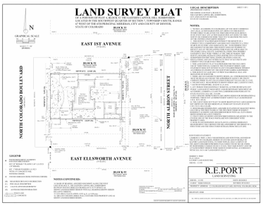
A Land Survey Plat establishes the boundaries of a parcel using its legal description which involves finding and/or setting the property corners. Additionally, all recorded and apparent rights-of-way, easements, and conflicting boundary evidence is depicted. A plat (18" x 24" or 24" x 36") is then drafted from the field work to provide a representation of the parcel surveyed and an explanation of how the property corners were established.
Land Survey Plats are typically performed to obtain building permits, resolve property disputes, and for building fences. Consult one of our professionals to help determine what type of survey you need.
